LIST OF ILLUSTRATIONS
Below are links to all the illustrations on the
site, listed by topic.
To return to this page after each photo, choose the "List
of Illustrations" link.
The Secret of Aerial Archaeology
Photos showing the difference between ground and aerial views:
 Ground
photo of a person standing in a field of rocks
Ground
photo of a person standing in a field of rocks
 Aerial
view of the same field, showing the true pattern
Aerial
view of the same field, showing the true pattern
 Ground photo of a buried pueblo (town) site, showing ground clutter
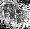 Aerial
photo of the same site, showing the layout of the buried town
Aerial
photo of the same site, showing the layout of the buried town
Aerial Archaeology in Mexico: the Casas Grandes/Cerros de
Trincheras Aerial Photo Expedition
 Map
showing distribution of Cerros de Trincheras sites
Map
showing distribution of Cerros de Trincheras sites
Vertical aerial photographs of cerros de trincheras (entrenched
mountain) archaeological sites:
 Cerro
Vidal (showing concentric stone rings around a hilltop)
Cerro
Vidal (showing concentric stone rings around a hilltop)
 Cerro
Juanaqueña (showing stone rings and terracing)
Cerro
Juanaqueña (showing stone rings and terracing)
 Cerro
El Gallo (showing stone rings around a hill)
Cerro
El Gallo (showing stone rings around a hill)
Mysteries of Chaco: The Aerial Perspective
 Map
showing the ancient Chaco culture area
Map
showing the ancient Chaco culture area
 Aerial photo of Pueblo Bonito ruin in Chaco Canyon
 Aerial
photo of a Chaco aureola (mystery circle)
Aerial
photo of a Chaco aureola (mystery circle)
Technical Discussions: What makes an archaeological site visible
from the air?
Aerial Photos:
 Shadow sites: Pueblo She'
 Vegetation patterns: Sapawe Pueblo
 Ground colors and textures: Mystery stone designs
Historical Notes: The 1927 Aerial Photography of a Wisconsin
Effigy Mound
 Plan
view of the Wehmhoff effigy mound.
Plan
view of the Wehmhoff effigy mound.
 1927 Aerial Photo of the Wehmhoff Effigy Mound
 Man in biplane, showing difficulty of shooting a camera through
struts
Man in biplane, showing difficulty of shooting a camera through
struts